Blackwell Portfolio
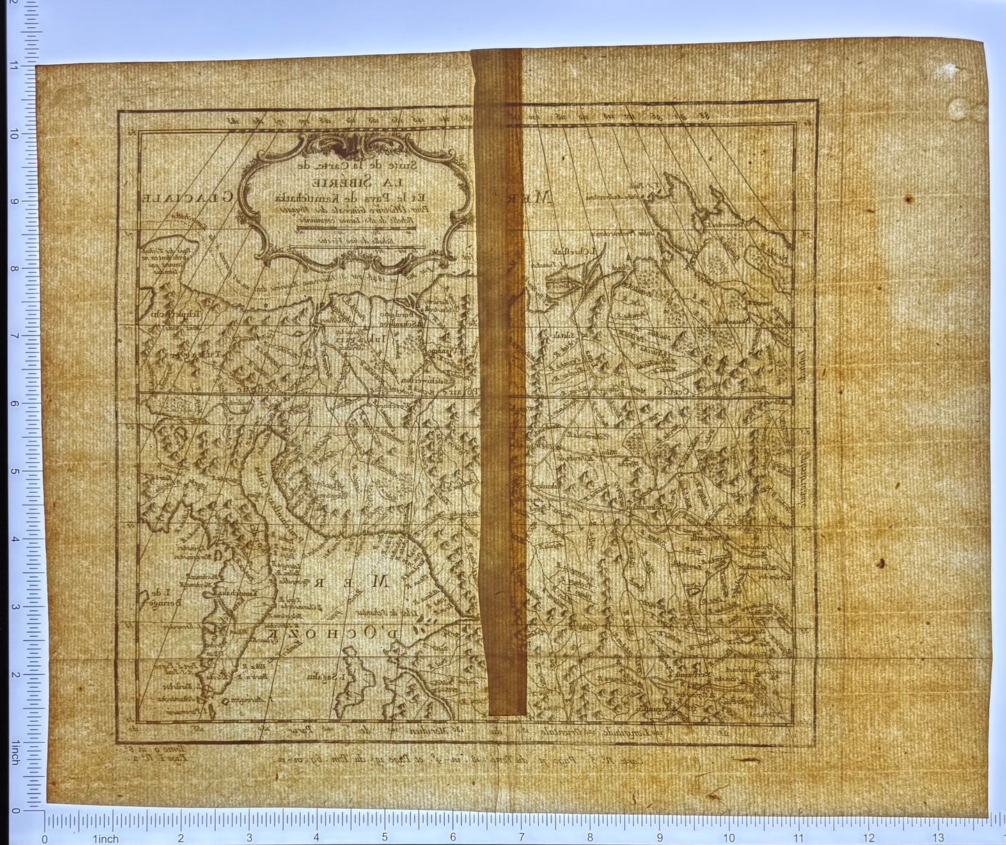
Suite de la Carte de la Sibérie et du Pays de Kamtschatka
Suite de la Carte de la Sibérie et du Pays de Kamtschatka
Couldn't load pickup availability
France, c. 1748
Copperplate engraving on laid paper
A striking mid-eighteenth-century French map charting Siberia and the Kamchatka Peninsula at the outer edge of European geographic certainty. Issued as part of the monumental Histoire Générale des Voyages, this plate belongs to the Enlightenment project of assembling the world through exploration, testimony, and engraved line.
The map depicts the Russian Far East, the Sea of Okhotsk, and Kamchatka as understood only decades after Bering’s voyages. Mountain ranges are rendered in confident relief, river systems push inland with speculative logic, and coastlines reflect a geography still being negotiated between observation and conjecture.
Printed on period laid paper with visible chain lines, the engraving remains strong, with crisp line work and legible toponymy throughout. The sheet shows the physical reality of eighteenth-century atlas production: irregular trimming, offset plate impression, and the quiet evidence of handling across generations.
Details
Title: Suite de la Carte de la Sibérie et le Pays de Kamtschatka
Date: mid-18th century (c. 1750–1780)
Place: Paris
Maker: Jacques-Nicolas Bellin
Medium: Copper engraving on laid paper
Subject: Siberia; Kamchatka Peninsula; Sea of Okhotsk; Sakhalin; Russian Far East; Arctic exploration
Dimensions: approx. 14 × 12 inches (sheet); plate within margins
Condition
Original vertical centerfold as issued, with additional folds at the lower left and lower right, the latter producing a slight overlap without ink loss. A narrow strip of period paper is affixed along the verso centerline; it does not join separate sheets and corresponds to no tears or structural breaks, suggesting a historical reinforcement or archival intervention rather than repair of damage. One small area of paper thinning is present at the upper right verso from an earlier adhesive removal attempt; there is no perforation and no loss of printed surface. A single adhesive dot remains at the upper left verso and has been intentionally left in place to avoid further disturbance. Irregular sheet edges and offset printing are consistent with eighteenth-century atlas production. Overall, a stable, intact example with honest signs of age and use.
Framing: Unframed
Provenance: Private collection
Portfolio: Blackwell Portfolio — Working Cartography
Share